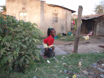
Nyalenda is the neighborhood where most of the orphants live. It is very poor and there is no infrastucture. During the rain period the area is flooded, which threatens the sanity as the pit holes and latrines are filled with water. Joseph has a figure of 65 000 children in the area, that are orphants.
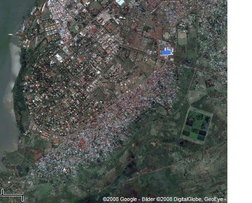
This is a satellite photo from Google-Map. You can clearly see the difference between the rich neighborhoods, with straight roads and the crowded houses in the slum area southeast of town center.
Our guesthouse is situated in the middle of the slums, you can see the red circle that points out the guesthouse. Not very far away from the shore of lake Victoria.
_________________________________________________________________________________________________


2010-06-24 at 07:03
Right now roads are being made in nyalenda, and it’s like we have to maps for 1960 and the latest, and most individuals used the latest map to build, between the two which is the correct map to be used?
2010-06-24 at 07:18
WHY WAS THE NEW MAP USED INCASE IT WAS WRONG?